
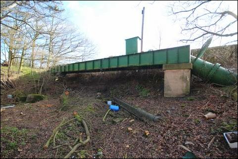
View back towards the road from the approximate position of the Lock
This new lock is required to allow canal access under the A461 Walsall Road where new road elevation does not permit a hump back bridge to the original dimensions.
Like Lock 9B, this will have a relatively low rise, about 1 metre, because these two locks will effectively replace the former Lock 9, sharing the rise between them.
This is the start of the Summerhill section leading west down to the Aqueduct. Restoration began in 2015 with an SIB grant.
| Access: | Private property - no access |
| Alignment: | On canal line |
| Huddlesford: | 5.40 Miles (8.70 Kms.) |
| Catshill: | 3.20 Miles (5.20 Kms.) |
52.65203, -1.88935
The Boat Inn is adjacent
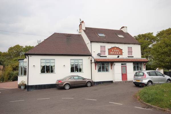
A461 Boat Inn Bridge
A new bridge will be required at this location to replace the original bridge removed shortly after abandonment. A cranked water pipe to the side of the road indicates the profile of the original canal.
| Access: | |
| Alignment: | On canal line |
| Huddlesford: | 5.90 Miles (9.60 Kms.) |
| Catshill: | 2.70 Miles (4.30 Kms.) |
52.65199, -1.88897

Old Coal Wharf
The Old Coal Wharf is located on the canal to the rear of Pointons Coal Merchants
| Access: | |
| Alignment: | On canal line |
| Huddlesford: | - |
| Catshill: | - |
52.65221, -1.88501
New Lock 9B
This new lock is required to allow canal access under the A5 Watling Street on an altered canal alignment to avoid modern developments in the old canal bed in this area
| Access: | |
| Alignment: | On canal line |
| Huddlesford: | - |
| Catshill: | - |
52.65517, -1.87949
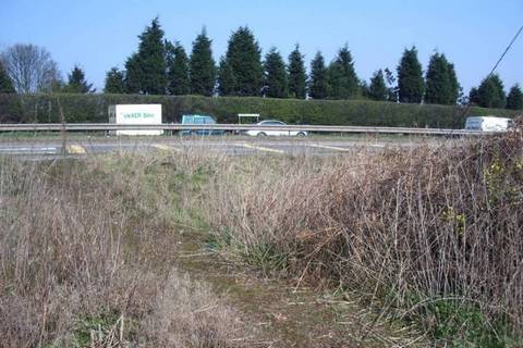
Approximate location for A5 crossing, looking north from Wall Butts
A new Tunnel is required under the A5 Watling Street on the new canal alignment in this location.
See the Atkins Feasibility Study for detailed analysis of the options.
| Access: | |
| Alignment: | On canal line |
| Huddlesford: | 5.40 Miles (8.70 Kms.) |
| Catshill: | 3.20 Miles (5.20 Kms.) |
52.65596, -1.87927
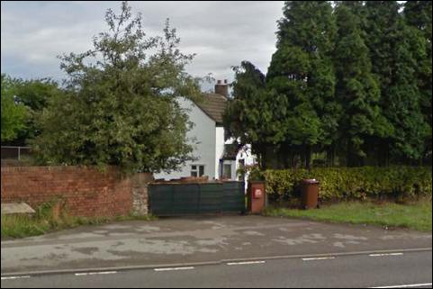
Danks Cottage, a typical BCN design, just visible from the A5.
The old Danks Cottage and wharf (site of) lie beside the A5.
| Access: | Private property - no access |
| Alignment: | On canal line |
| Huddlesford: | - |
| Catshill: | - |
52.65644, -1.88004
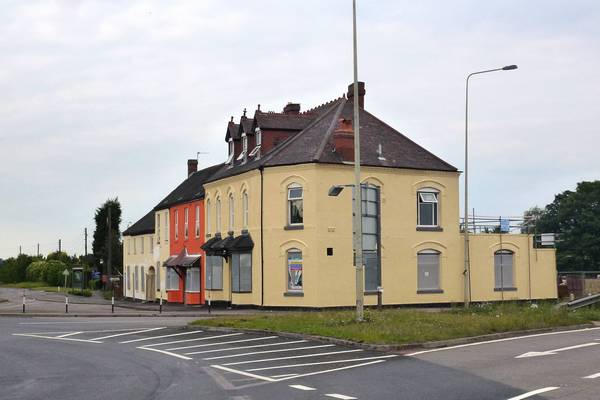
Muckley Corner Canal Inn
The 'Muckley Corner' was the original Old Coaching Inn and parts of the building date back to 1683. An inn was recorded there in the 1790's.
In 1891 the building together with 8 acres of land was sold to a brewery. The brewery demolished a substantial amount of the old inn and incorporated the reminder into the new Inn.
The Old Muckley Corner has been recently re-developed into residential properties.
| Access: | private |
| Alignment: | West of canal 100m. |
| Huddlesford: | - |
| Catshill: | - |
52.65631, -1.88094
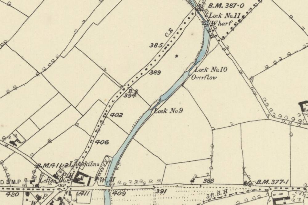
Old Locks 9 and 10 on O.S. Map from 1883
The canal line needs to deviate south of Lock 9 and the original route where the old line has been developed since abandonment.
| Access: | Private property - no access |
| Alignment: | On canal line |
| Huddlesford: | - |
| Catshill: | - |
52.65813, -1.87801
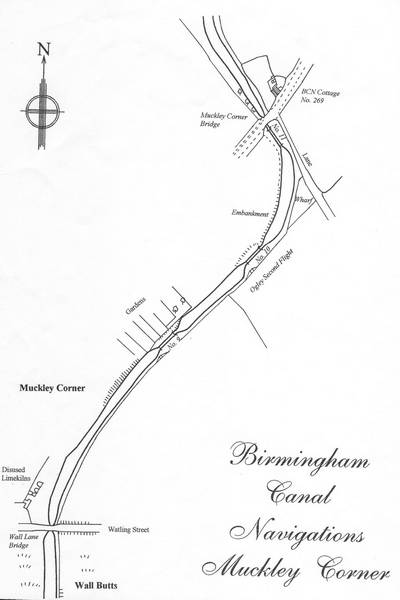
Ogley 2nd flight - drawing by Duncan A Moore.
Locks 9 to 12 form Ogley 2nd flight.
Lock 10 is in-filled and can be restored.
| Access: | Private property - no access |
| Alignment: | On canal line |
| Huddlesford: | - |
| Catshill: | - |
52.65904, -1.87639
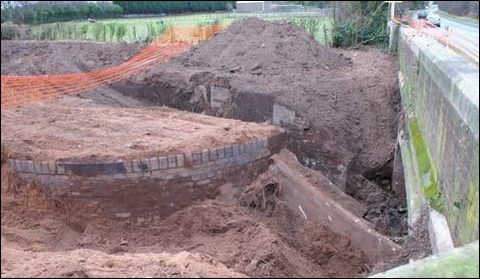
Lock 11 and Site of Former Muckley Corner Wharf
Lock was excavated in 2009 , inspected and found to be structurely intact, and was re buried to preserve until required.
The adjacent cottage is shown on 1920 plans as BCN 269.
See Captain Ahab's Watery Tales on this section.
| Access: | Private property - no access |
| Alignment: | On canal line |
| Huddlesford: | - |
| Catshill: | - |
52.66045, -1.876