
Hatherton Canal - Then, Now...and What Next?
Hatherton Canal Restoration
Most of the restoration focus over recent years has been on the Lichfield Canal. However, the Trust campaigns for restoration of both of the Northern Links to the BCN. In this article Duncan Moore takes a look at what it would take to restore the Hatherton Branch.
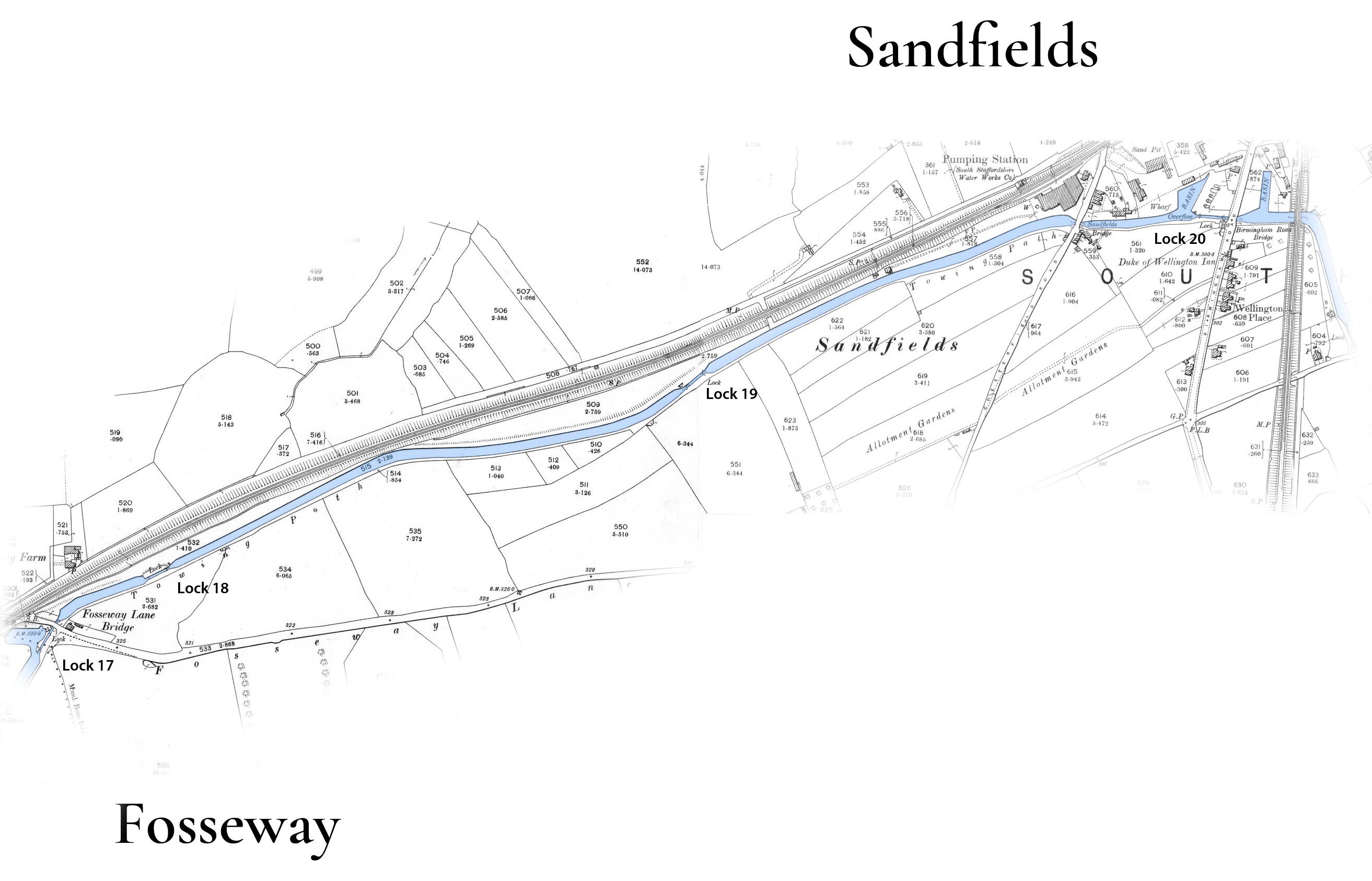
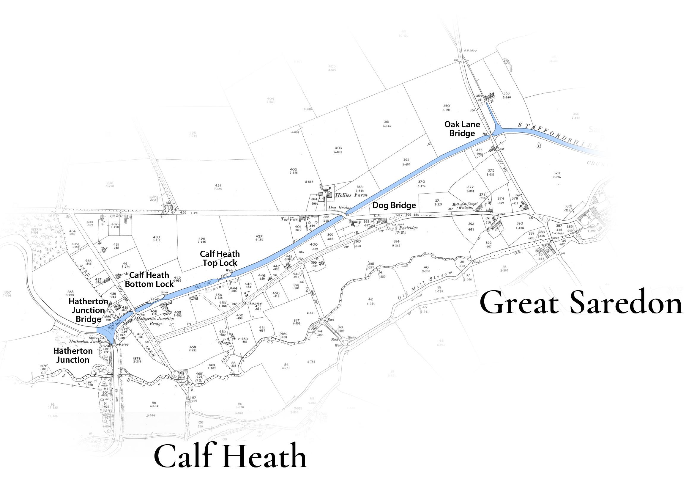
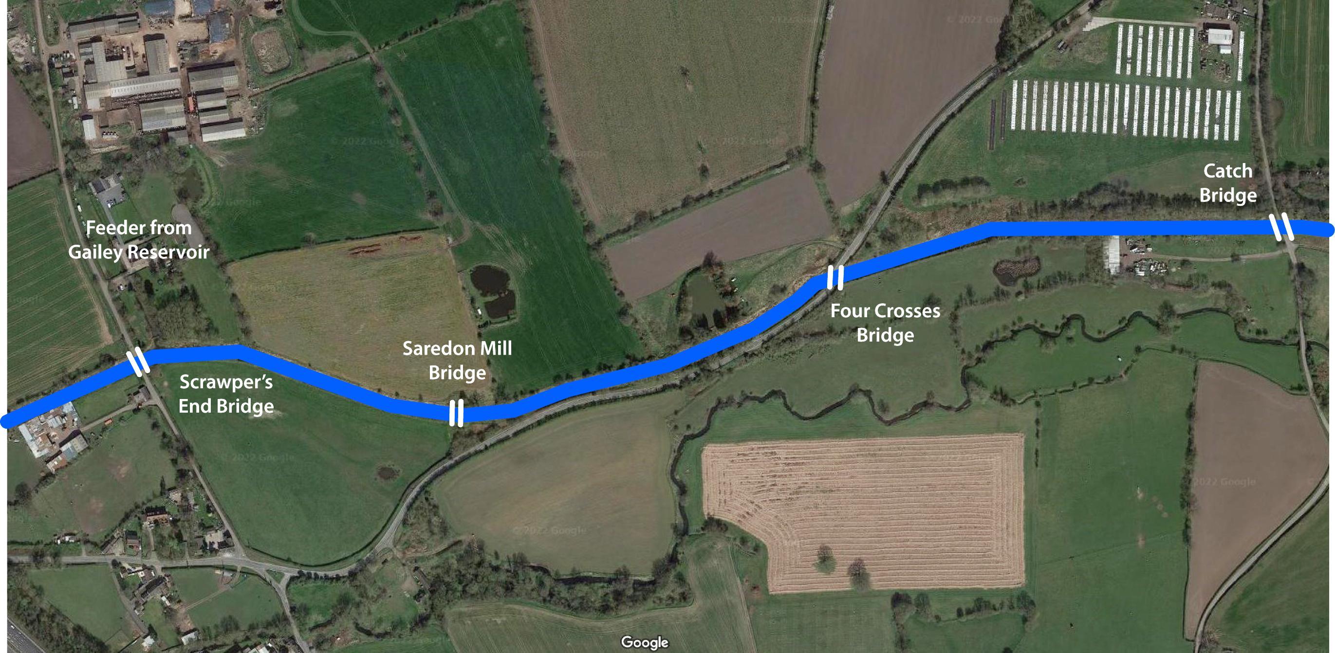
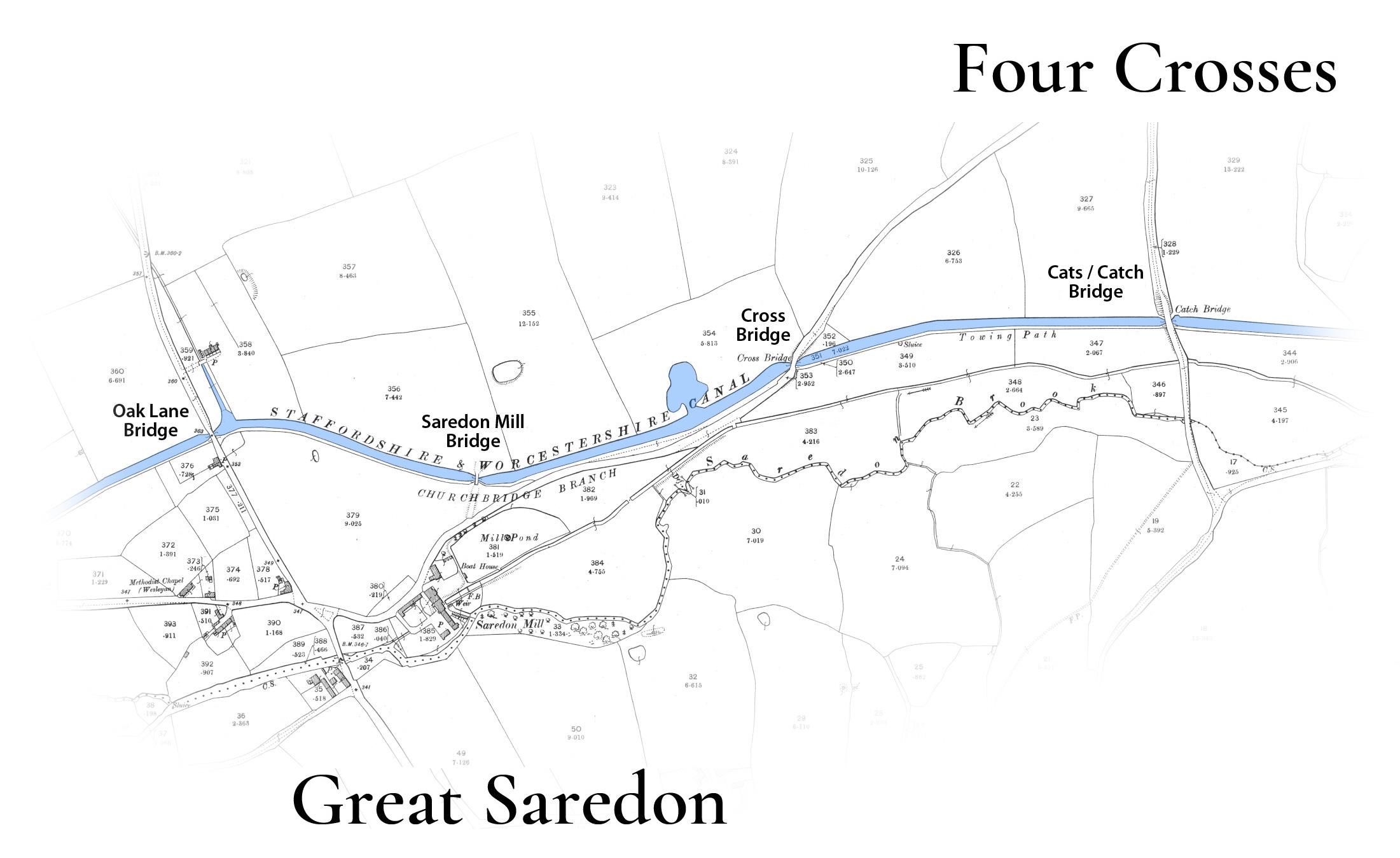
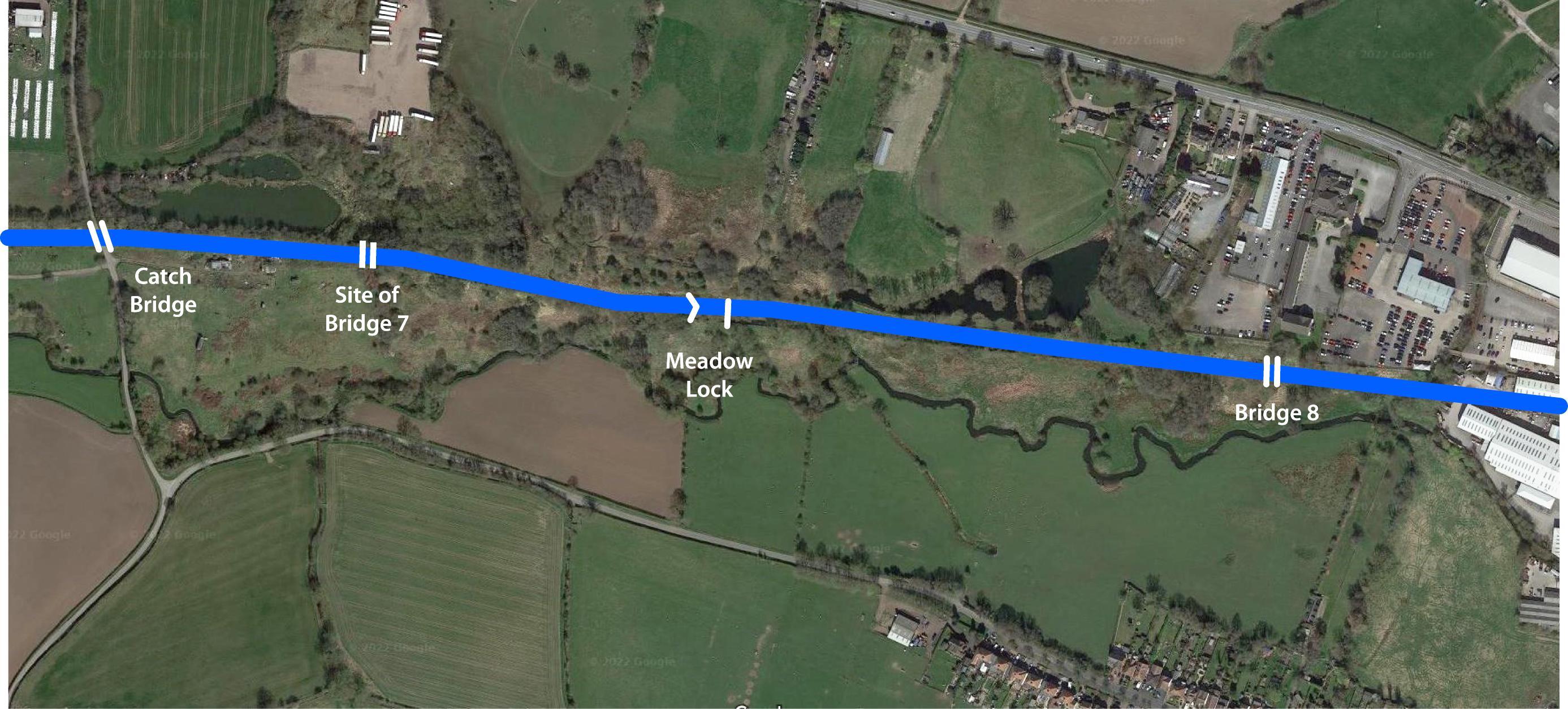
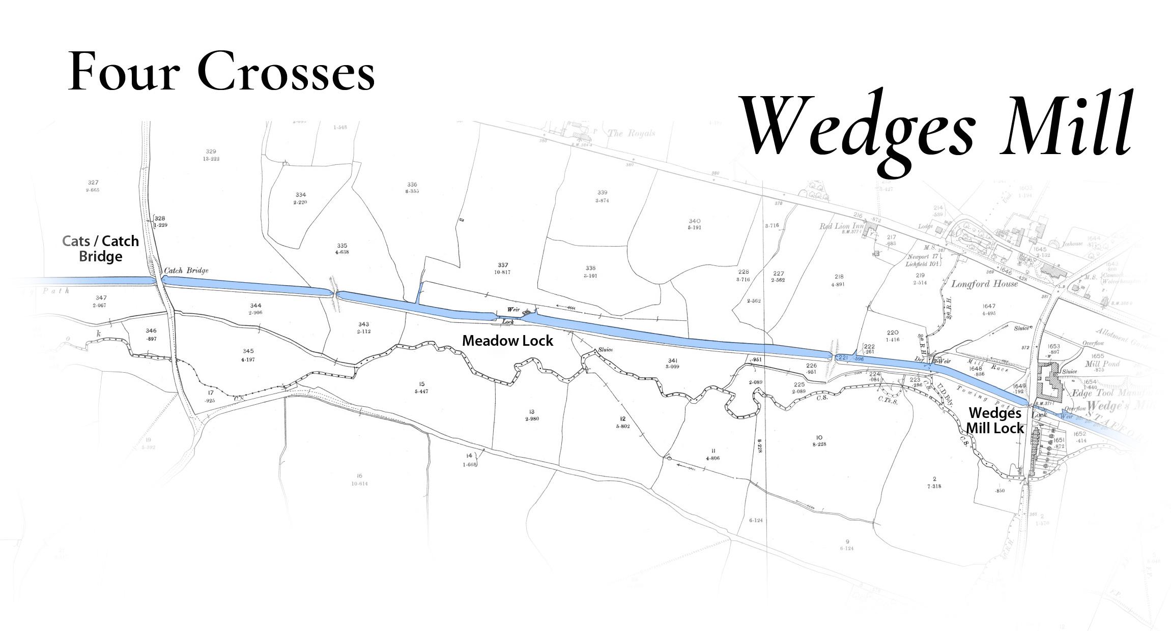
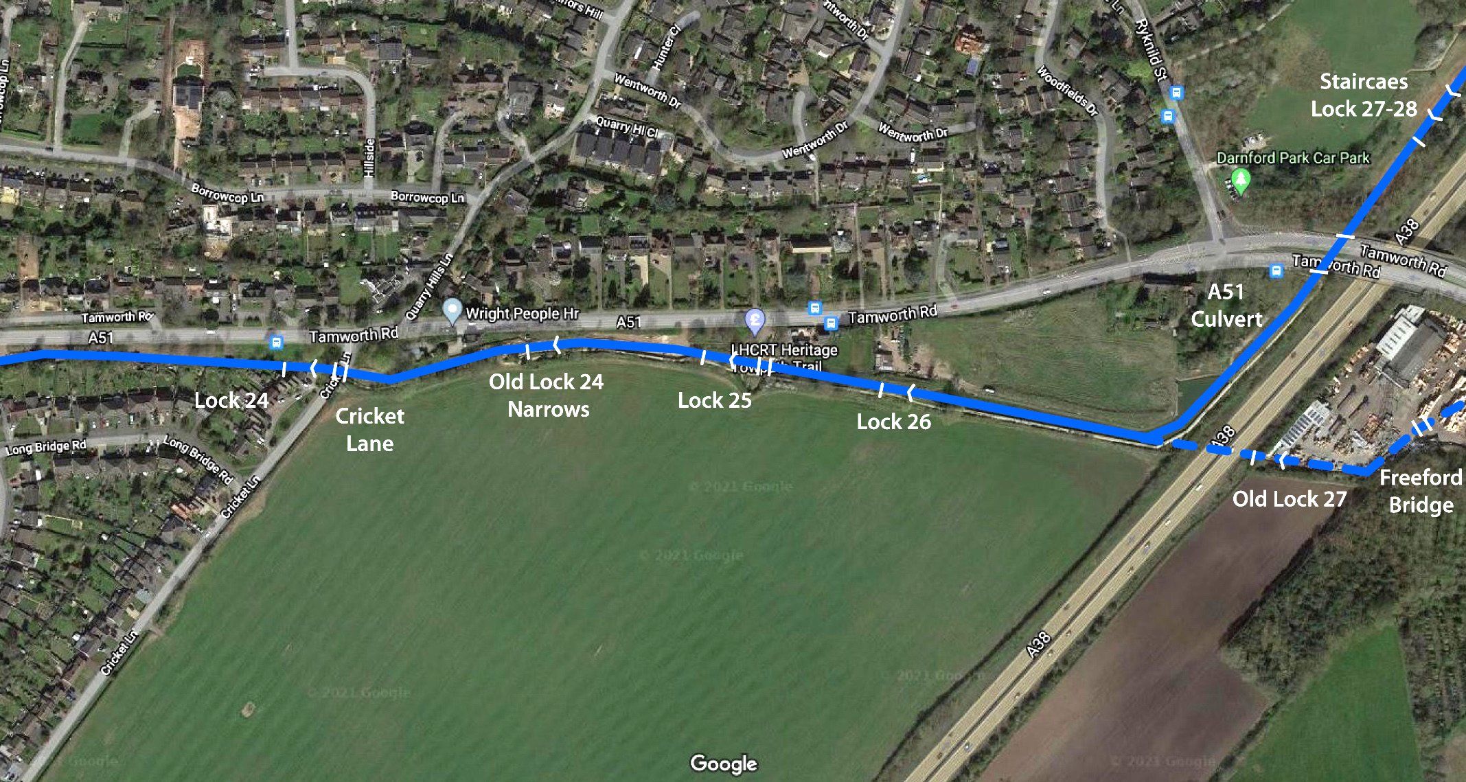
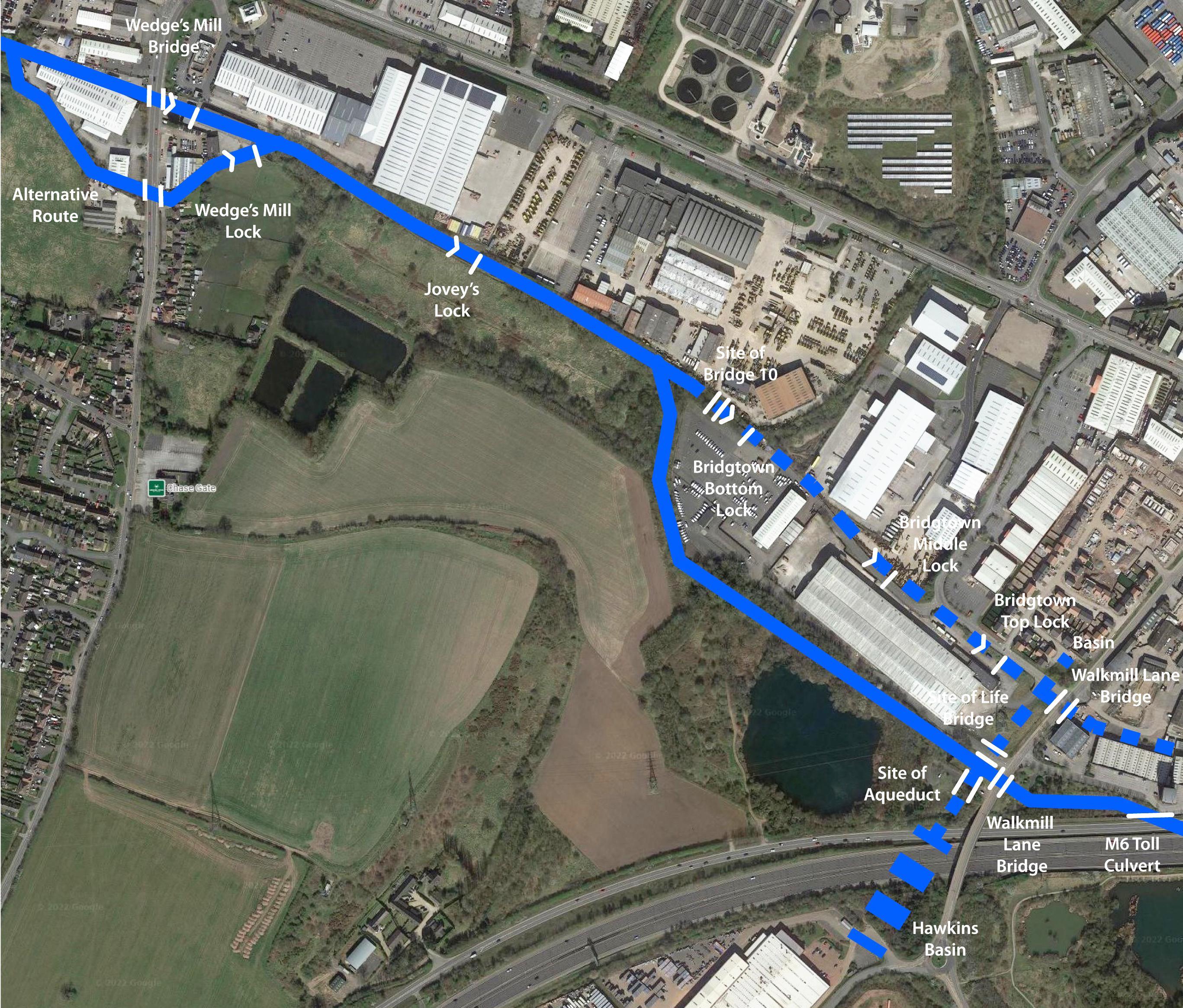
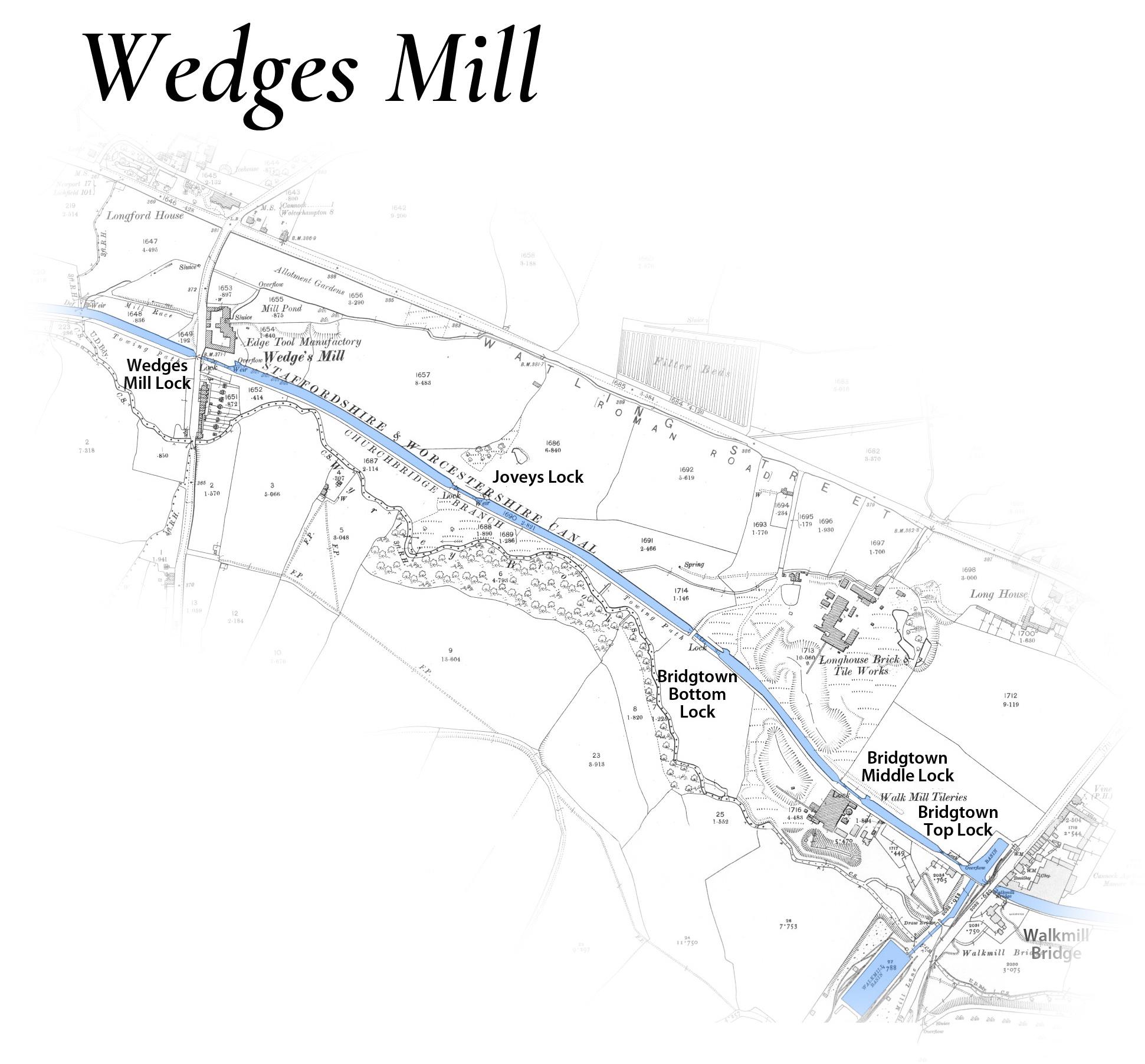
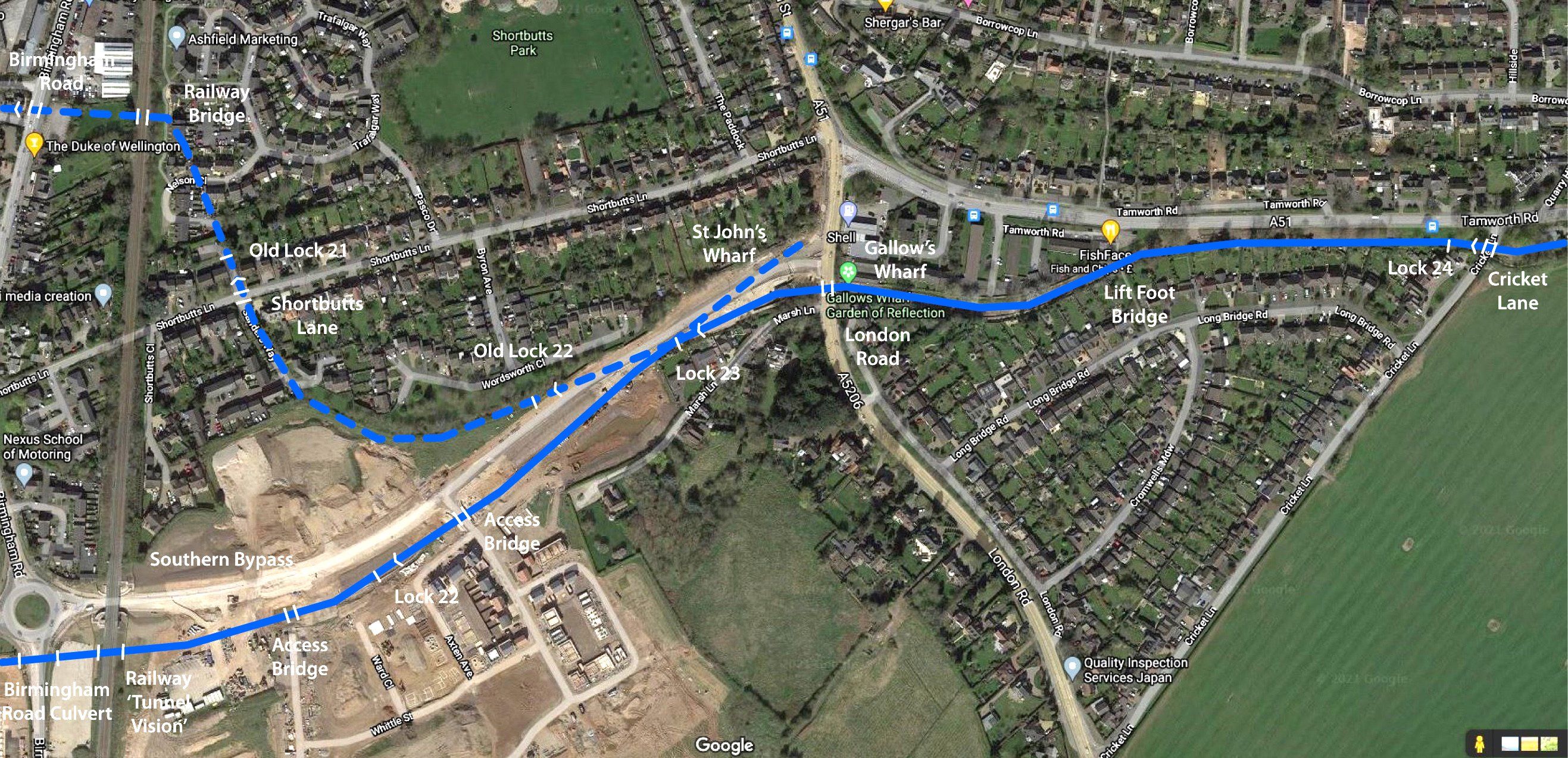
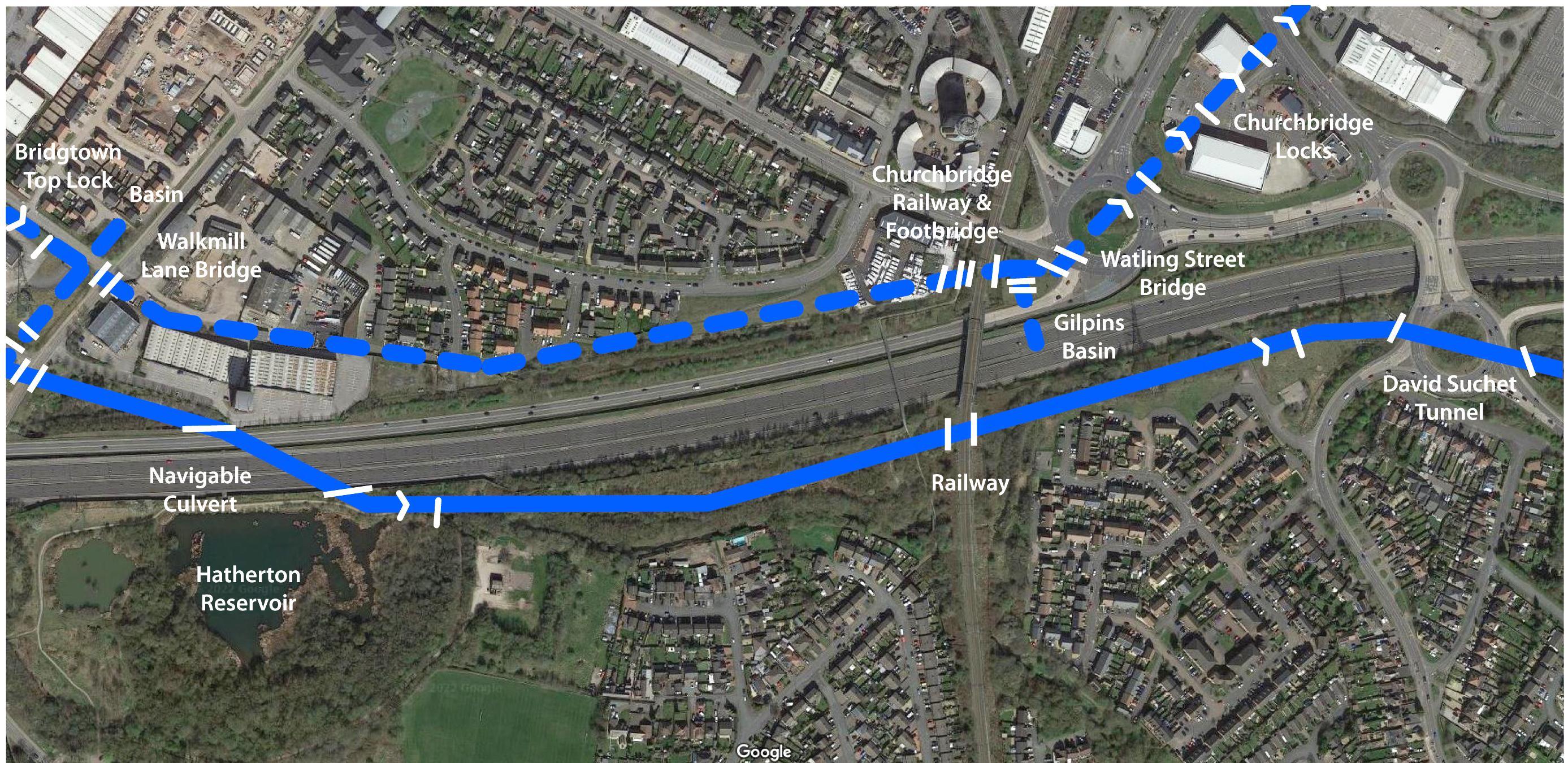
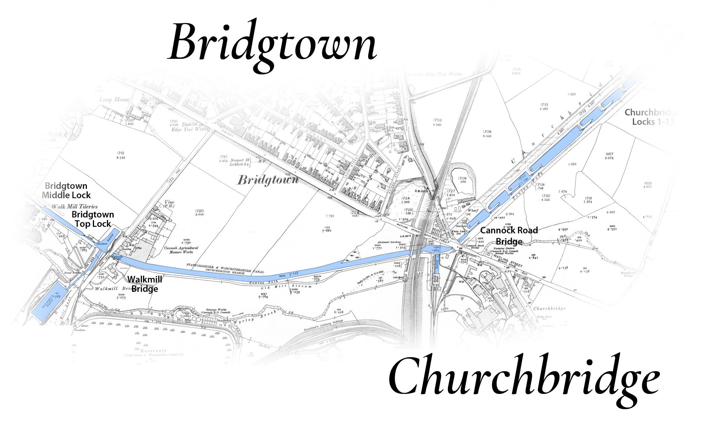
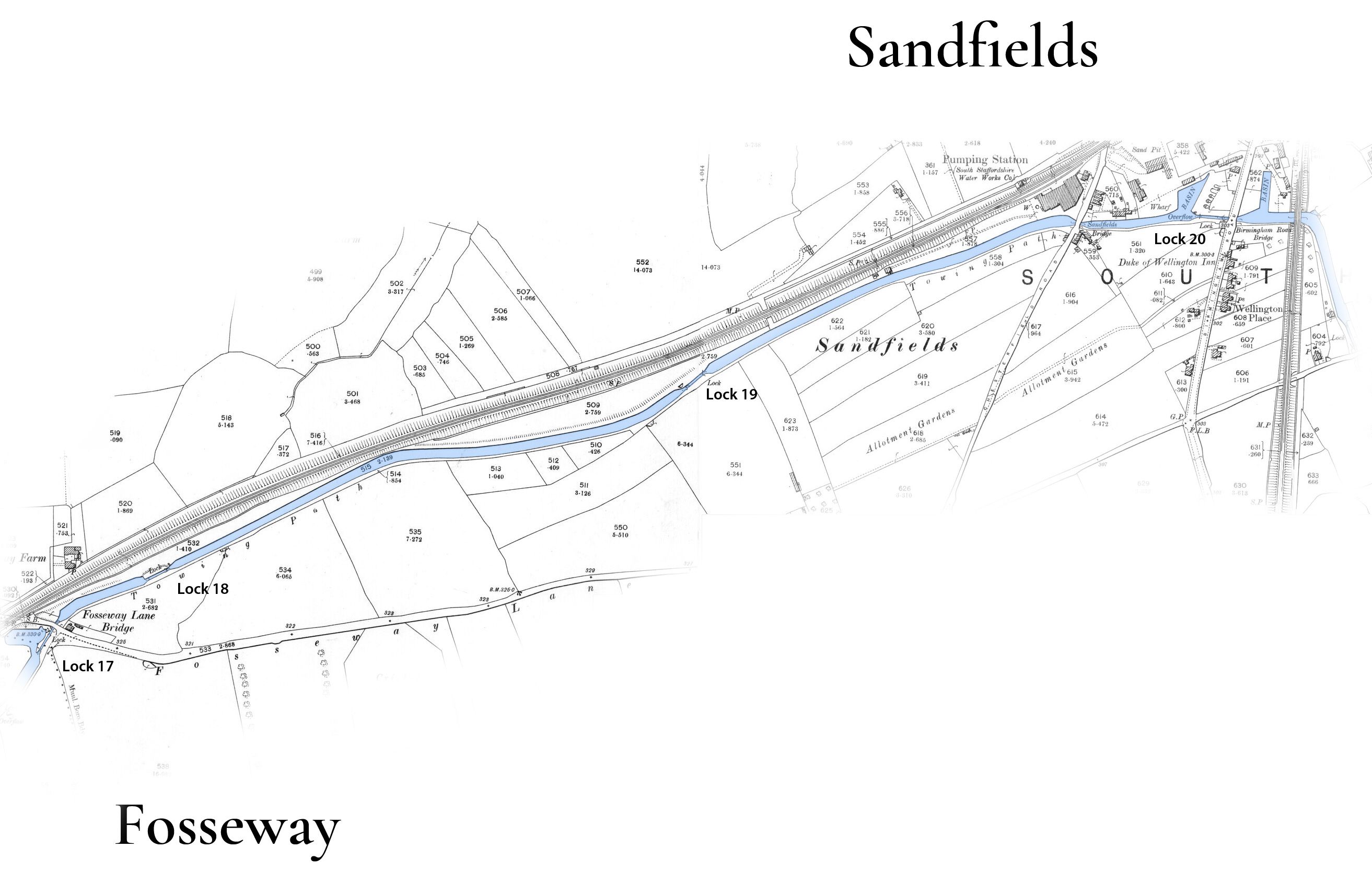
Google Imagery from 2021 can be compared here with Ordinance Survey 25 inch to 1 mile maps from 1920 on maps prepared by Duncan Moore - Click to enlarge.
for further reading...
Much of the Trust's plans are based on the Hatherton Canal Feasability Study by Ove Arup of 2006, and the associated maps. Then in 2009 a further feasibility report was carried out by Atkins Ltd. to find a more viable route to connect with the BCN. See the Supplementary Hatherton Canal Feasability Study
Another fascinating way to compare then and now is with side-by-side maps at the National Library of Scotland.
For many more archive images see Duncan Moore's Lost BCN Image Library.
...and 'Captain Ahab's Watery Tales' on the Hatherton Branch Canal,
Don't miss the Andy Tidy Canal Hunter videos including The Hatherton Branch Canal.
On this website see also Hatherton Canal - An Overview.
A short survey of what we need to do
Hatherton Canal - from Calf Heath to Rumer Hill
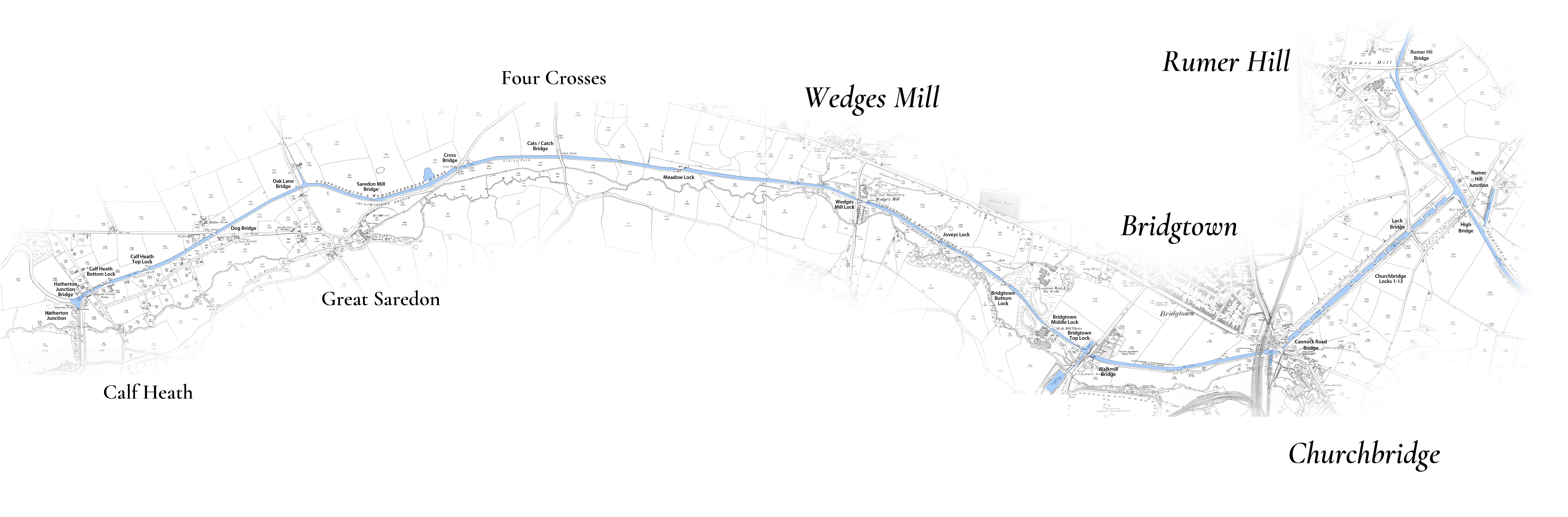
The North Western link to the BCN originally consisted of three parts, the Hatherton Branch of the Staffs and Worcester Canal, the Cannock Extension Canal and the flight of thirteen locks that connected them at Churchbridge. Churchbridge Locks and a significant length of the Cannock Extension were swallowed up by open cast mining, the line was lost and has since been obstructed beyond recovery. If the link between the Staffs and Worcester and the BCN is to be recovered it will require a new link to replace the Cannock Extension and the Churchbridge Lock Flight. This article will consider just the Hatherton Branch.
The restoration of the Hatherton Branch falls into three distinct sections:
-
The first length from the junction at Calf Heath to Wedges Mill is maintained in water by the Canal & Rivers Trust as it feeds the Staffs and Worcester Canal from Gailey Reservoir, but is blocked by five road crossings.
-
The central section between Wedge’s Mill and Walkmill is obstructed at both ends, Walkmill and possibly Wedge’s Mill as well will require a diverted line. Between these two blockages a brook has been diverted into the line of the canal and the route is inaccessible.
-
The Eastern, end running from Walkmill to Churchbridge, will require a new line, but two navigable culverts were installed when the M6 Toll Motorway was built which makes this length much more straightforward than would otherwise have been the case.
Let’s consider the route in more detail, starting at Calf Heath and heading East.

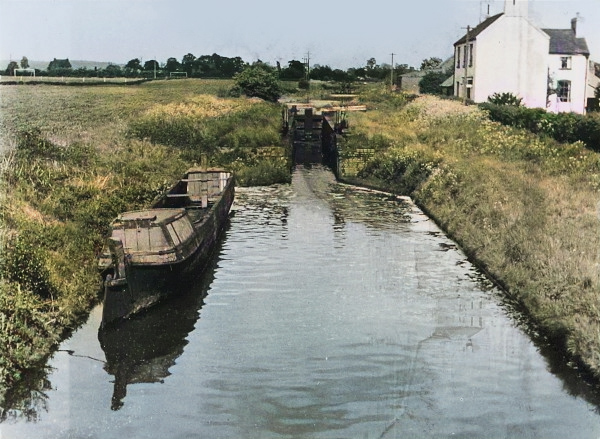
Calf heath bottom lock in 1955 Photo: Arthur Watts CRT
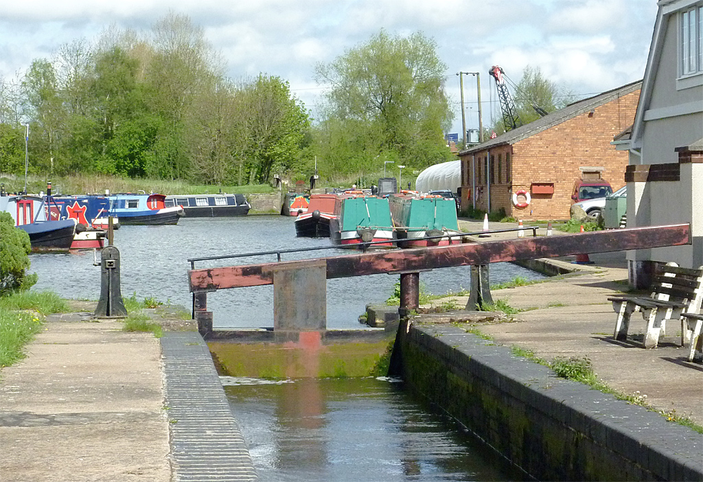
Calf Heath Bottom Lock, Hatherton Canal in 2012 (Lock 2 in the distance)
Photo: © Roger Kidd (cc-by-sa/2.0
The Junction Bridge and the bottom of the two Calf Heath locks are still in use and allow access to the marina in the pound above. The upper lock survives, but a shelf has been cut out of one side to form a dry dock for the boatyard. The channel above is in water although choked with reeds and the remains of abandoned boats.
The next bridge was Dog Bridge which was demolished when the M6 was built.
Shortly beyond Dog Bridge the M6 Motorway crosses the canal on an embankment. There are several alternatives at this point. If the road can be elevated Dog Bridge could be replaced. If not, then the canal would need to be lowered by a new half lock just before the M6 and the channel lowered back as far as Calf Heath top lock, which would lose some of its fall.
The M6 embankment is high enough for the canal to tunnel underneath at its existing level. An alternative is that the canal could be realigned and share the existing road bridge under the M6. This would save the cost of a new tunnel but would present other challenges of accommodating both the road and the canal, and a sharp turn in and out of the bridge.
In the early days of the trust there was a plan to widen the M6 and £3M was allocated to reinstate the canal under the M6. This seemed so likely to happen that a planning application was submitted for a new marina to the East of the M6. However, the plan to widen the M6 was replaced with an upgrade to a smart motorway which did not require a new tunnel. A future opportunity like this is most likely to overcome the M6 obstruction.
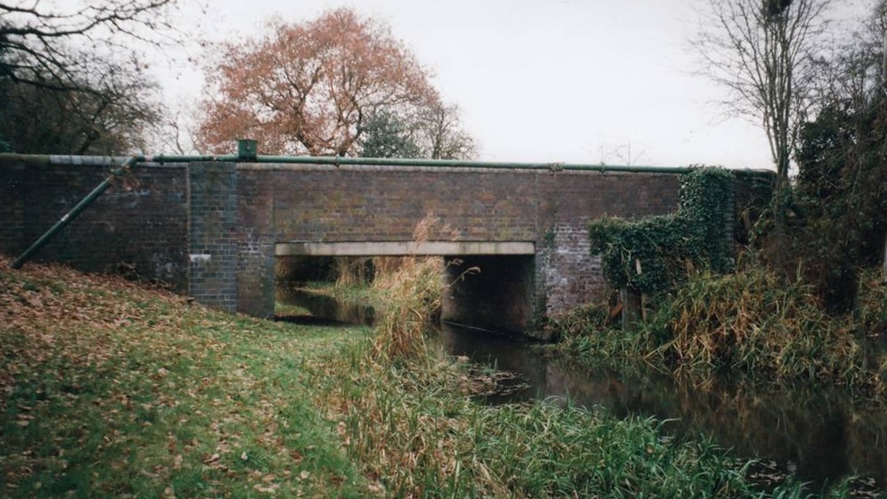
Scrawpers End Bridge (No. 3) Oak Lane with it's flat deck in 2016. Photo: Carol Cooper
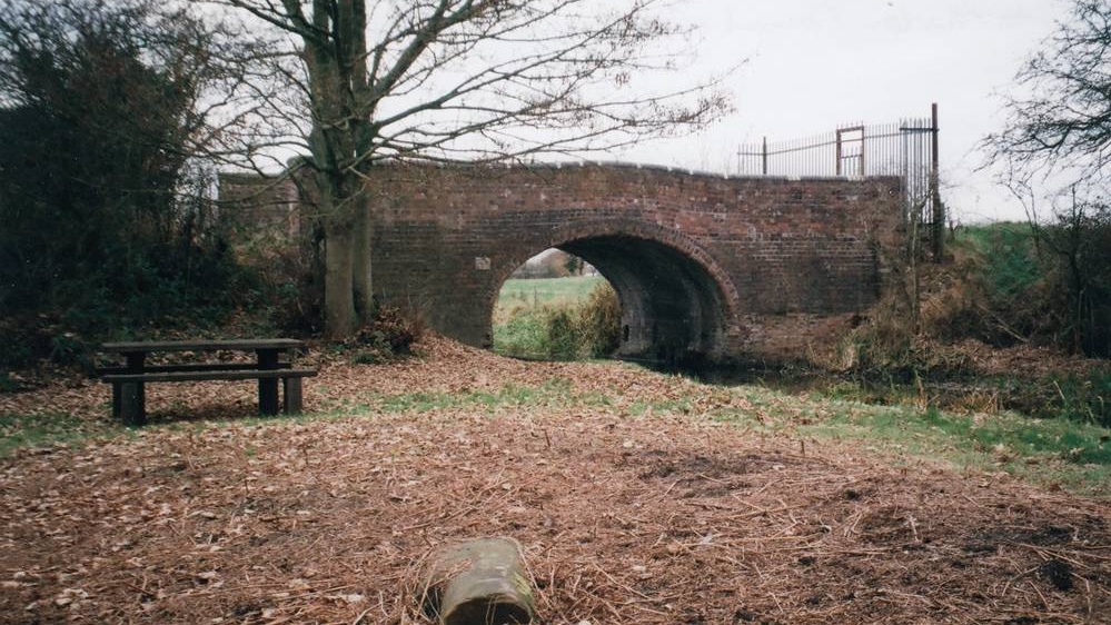
The restored Saredon Mill Bridge and picnic bench in 2016. Photo: Carol Cooper
More pictures here show what a pleasant walk this section can be.
Oak Lane (Scrawper’s End) Bridge exists but the arch has been replaced with a flat deck. The road will need to be raised by about a meter to accommodate navigation. The next bridge at Saredon Mill has already been restored by the trust. The bridge beyond, Four Crosses, has also had its deck lowered which will also require raising to allow navigation. The next bridge, Catch Bridge, was heavily affected by subsidence and was a reason for the abandonment of the branch in the fifties. It has been replaced by a causeway and will require a new bridge. The canal continues in water to the East of the bridge until Meadow Lock.
The lock itself survives, although showing considerable signs of subsidence. At the end of its working life it regularly overflowed making its operation very tricky. Above the lock there is a trickle of water in the channel. This length is crossed by another accommodation bridge, no 8, which has also been restored by the trust. This first section of the canal is in good condition, save for the lowered crossings. Its restoration will be expensive with limited volunteer involvement, save possibly the restoration of Meadow Lock.
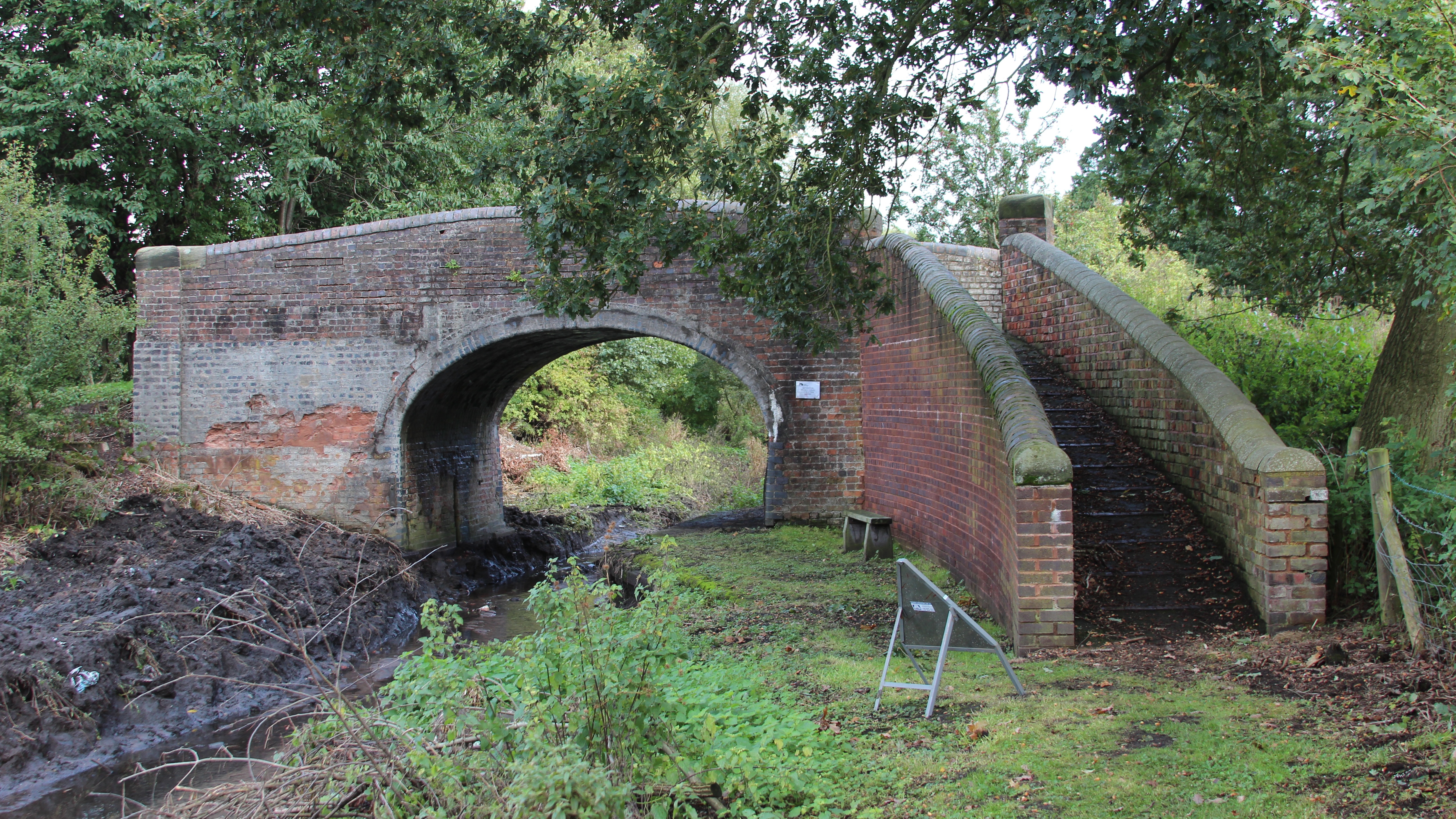
The restored accommodation bridge 8 near the Roman Way Hotel in 2013.
Photo: Paul Marshall
At Wedge’s Mill there has seen some encroachment on the line of the canal by industrial units. The bridge was demolished and the lock infilled in the 1960’s when the road was widened. There may still be room to squeeze the canal and lock in close to its original route if there’s enough height for the road bridge, otherwise the route could be diverted into the brook a little to the South and a new lock build to replace Wedge’s Mill lock.
The section above is inaccessible. A brook has been diverted into the channel of the canal and now runs straight through the chamber of Jovey’s Lock. The canal and stream could follow the same course provided adequate bywashes were provided, or the stream could be rerouted slightly to the South.
The brook leaves the canal line just before the bottom of the three Bridgtown locks. The bottom lock survives, but immediately above the line has been buried beneath an access road for warehouses and the upper two locks demolished.
This second length is not as secure as the first. The length where the brook follows the line is reasonably well protected but there is danger of further encroachment at Wedge’s Mill. However, this length has more potential for volunteers to be involved in the restoration.
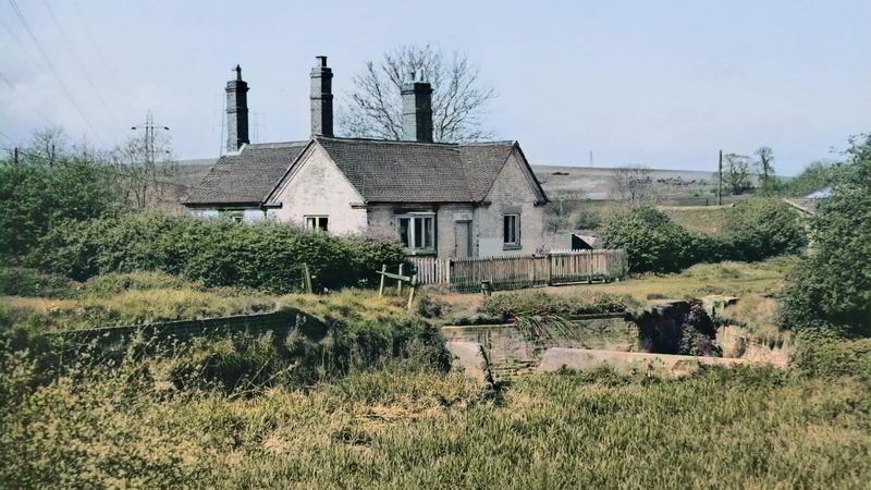
Bridgtown top lock Photo: Barrie Harley 1971
From Bridgtown bottom lock the original line to Churchbridge is lost and a new channel will have to be created. The new line would leave the old just below Bridgtown bottom lock and continue to follow the brook, crossing the line of the old arm to the massive Hawkins Basins. Immediately after this it will require a new bridge under Walkmill Lane, to the South of the original bridge and at a lower level.
Shortly afterwards the brook and canal pass under the M6 Toll in a navigable culvert that was installed when the motorway was built. Beyond the culvert a new lock is required by the old Hatherton Reservoir, which is one possible location for a new terminus to the branch before the new link to the BCN is constructed.
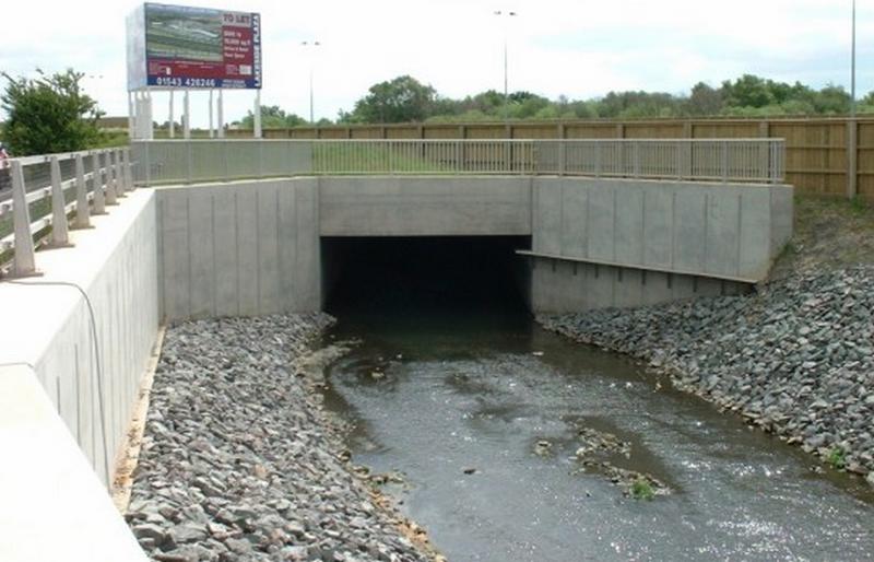
Culvert 144 underneath the carriageways of the M6 Toll. Photo: Bob Williams
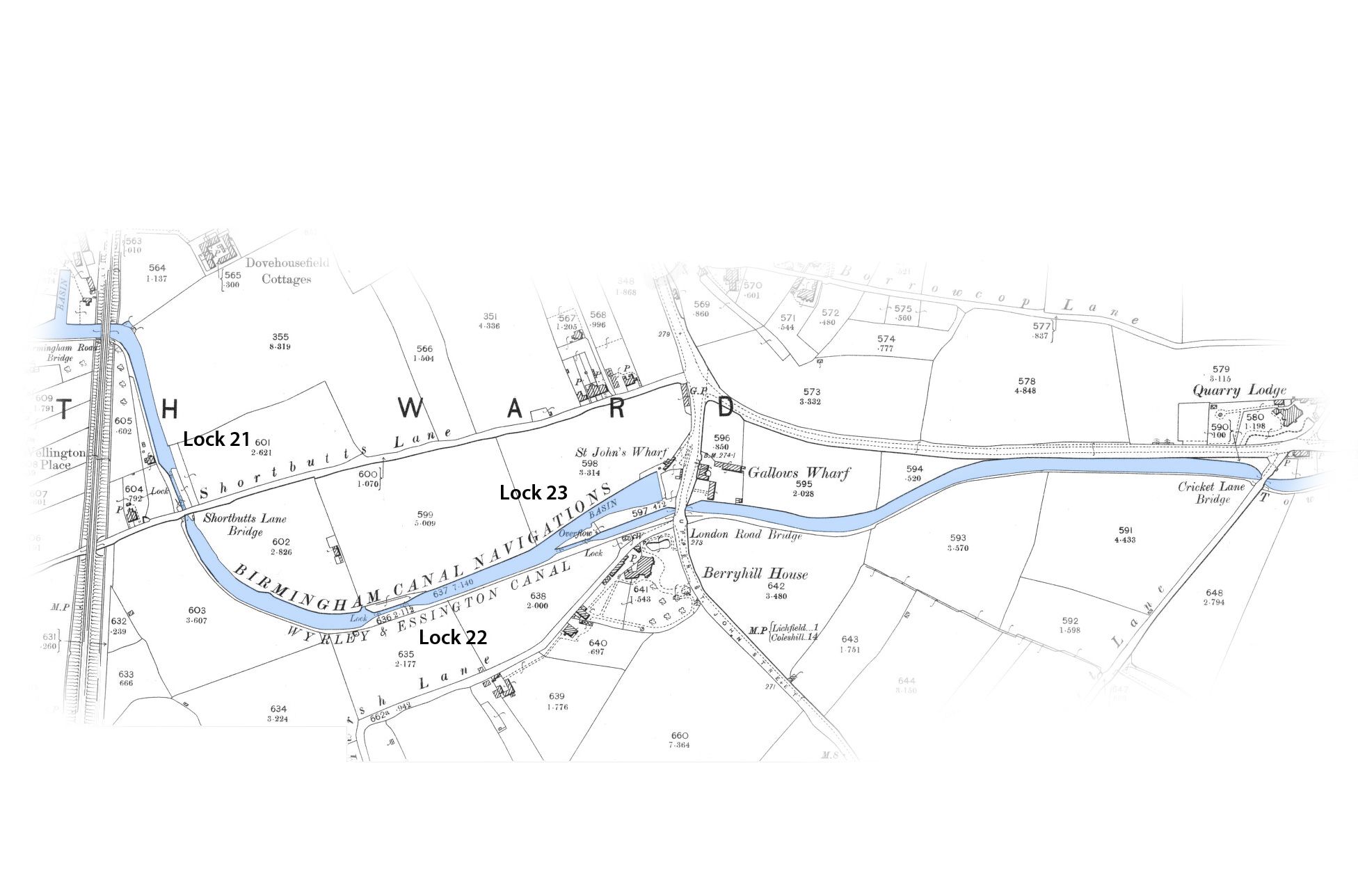
The new channel would then continue East alongside the motorway with a new tunnel required under the railway embankment, just across the motorway from the old railway viaduct and the bottom of the Churchbridge locks. A little further along a further new lock will be required to bring the canal up to the level of the David Suchet tunnel under the A5 roundabout which was installed at the Trust’s expense when the motorway was built. The alignment of the entrance to this tunnel is a little tricky due to a power pylon.
From here the canal will run through open land between the A5 and the M6 Toll, but this is beyond the end of the Hatherton Branch and will be part of the new link to the Northern BCN. This third section from Bridgtown Bottom Lock is new construction but again there is considerable potential for volunteer involvement in the work.
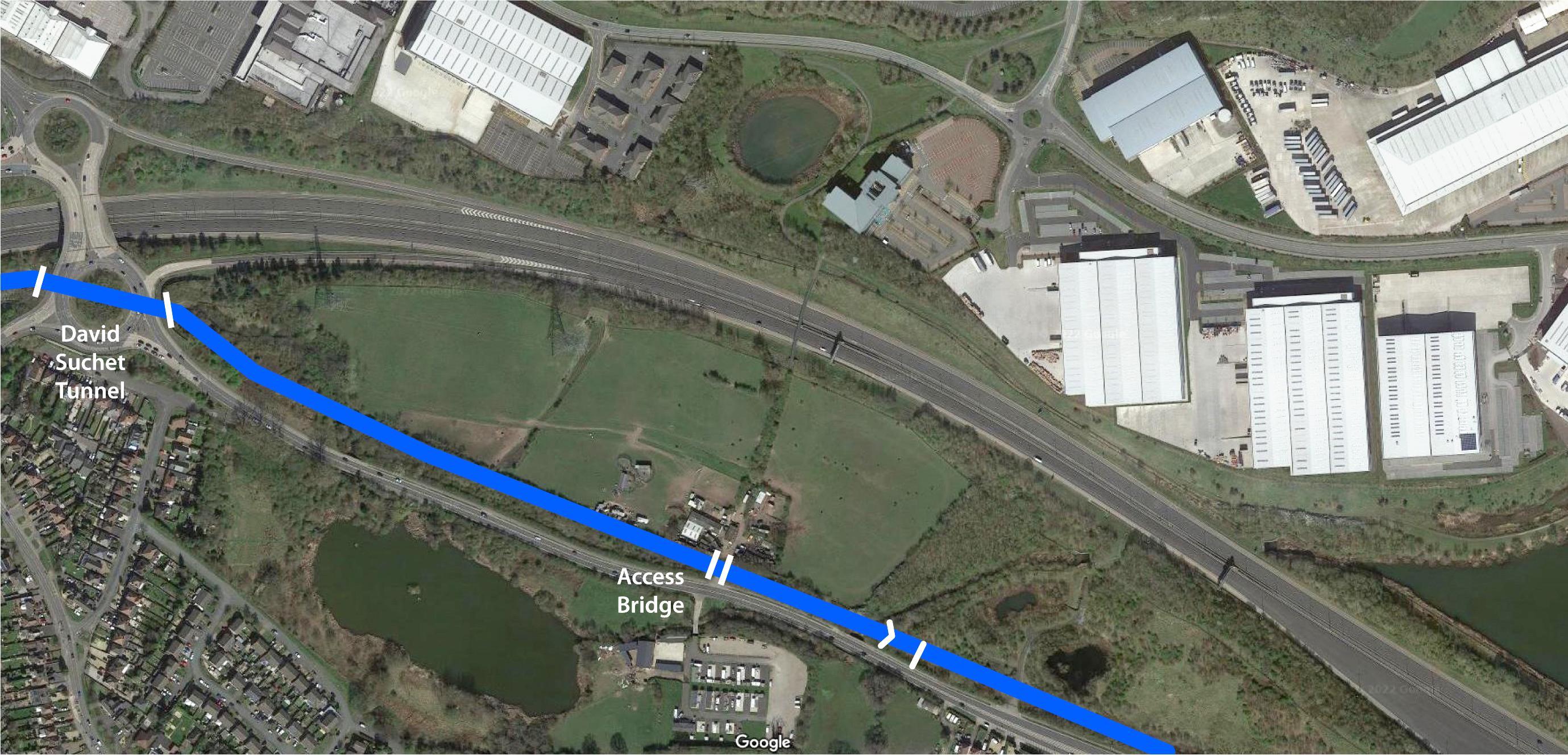
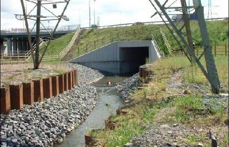
Culvert 155, "The David Suchet Tunnel" Photo Bob Williams
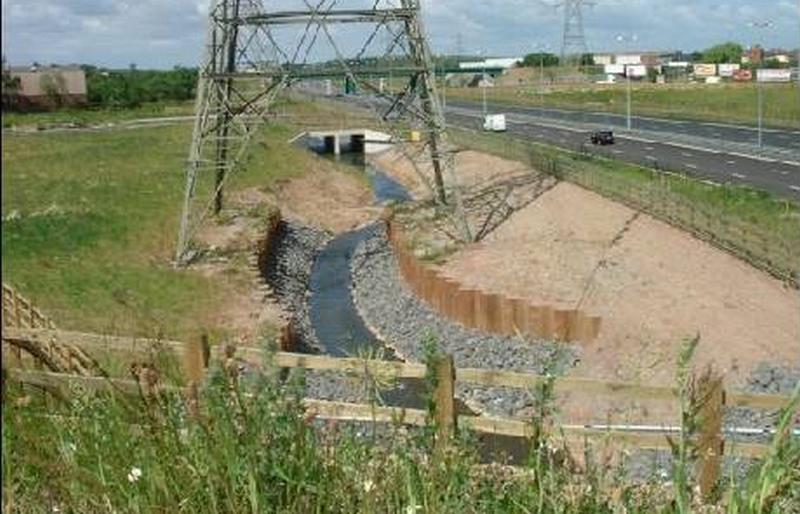
Looking west from the David Suchet Tunnel Photo: Bob Williams
Thus the restoration of the Hatherton Branch is, in some ways, more straightforward than the restoration of the Lichfield Canal. However, the first length requires a number of expensive new bridges. Replacing Dog Bridge and passing under the M6 will probably require a specific future opportunity similar to that which arose when the Motorway was to be widened.
Duncan Moore November 2022
A detailed feasibility report was carried out by Atkins Ltd. in 2009 to find a viable new route to connect with the BCN. For more details of how the route could now connect to the Wyrley and Essington Canal via the original Lord Hayes branch, including estimates of cost, see the Supplementary Hatherton Canal Feasability Study
Changing Times
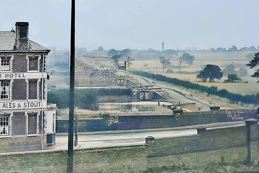
White Lion Pub (demolished 1973) and Churchbridge Locks 13-10 in 1926. Photo: Cannock Library See History of the White Lion here
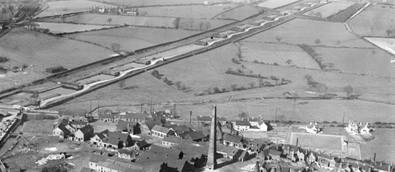
Churchbridge flight from the air Photo: Britain from Above
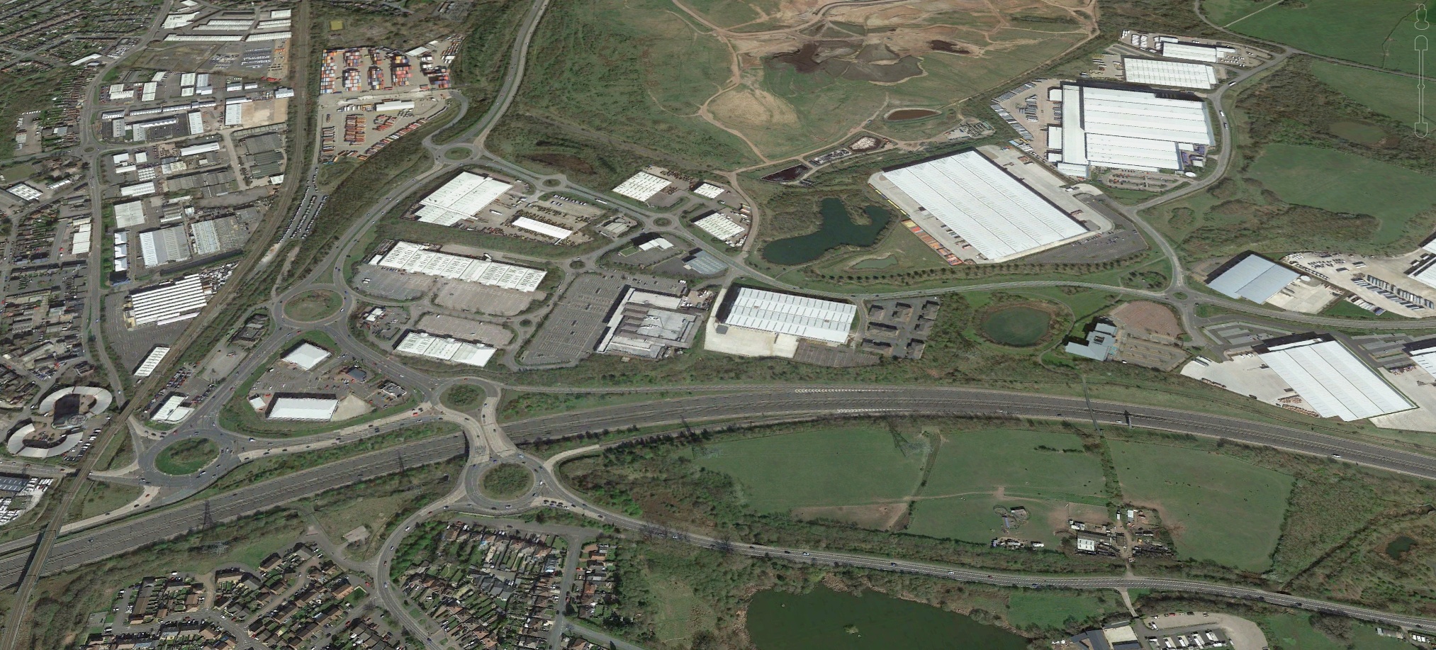
Approximately the same view today. Photo: Google Earth 2021


LICHFIELD AND
HATHERTON CANALS
RESTORATION TRUST
LHCRT.org.uk
Home Page
About Us
Contact Us
Strategy and Policies
Registered Office:
Island House, Moor Road
Chesham, Buckinghamshire
HP5 1WA
Registered in England - No. 2456172
Registered Charity No. 702429
VAT registration No. 823 8213 41
LHCRT is a member of the
Inland Waterways Association
and the
Staffordshire Waterways Group
Website design by Paul Marshall